

Description
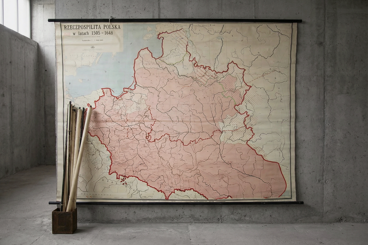
This large historical map published by Państwowe Przedsiębiorstwo Wydawnictw Kartograficznych in Wrocław in 1967, prepared by Zbigniew Rzepa. It presents the Republic of Poland in the years 1505-1648 in a scale of 1: 1,000,000. The map has an approval from the Ministry of Education in 1959. Offset printing has been placed on a canvas attached to wooden slats.
Everyone can see what Poland is like. And in the times from Sigismund the Old to Władysław IV Vasa, it was different. Somehow, there was more of this Poland. And so tolerant, pink. A little nostalgia occurs when we look at it. It is reminiscent of the times when in primary school you ran to the end of the classroom looking for a map appropriate to the topic of the lesson. Then she was hung on a slightly unstable tripod, glad that already five minutes of the lesson had passed. It is true that the enthusiasm was already dying out when, after the lesson was finished, it was necessary to roll up the map at the cost of a precious break. These times will not come back, but you can have a piece of history in your apartment.
The map has trained several generations and you can see the effort put into educating young people on it. It is yellowed, torn and folded. She has passed through thousands of hands, but this only proves her frequent use, so we can be grateful to her for the effort she put into learning. Now she is in for retirement, where she can proudly hang on the wall. Who will go for the map, hand up?


